
The 5 countries project
Today's ride was the ultimate exercise in mixing pleasure with business. I had to spend a few days at my company's Zurich office, conveniently straddling a weekend - so I took my bike along with me for a couple of days of adventure.
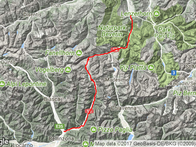
I decided to resurrect a project I'd started to plan five years ago (when we still lived in Zurich) but had never executed: a ride joining up five countries. Four of them - Germany, Austria, Switzerland and Liechtenstein, clustered together at the southern tip of Lake Constance - would be relatively easy to "collect", but adding Italy as the fifth would be the stretch target. Whichever way I looked at different route options, it was going to add about 100km to the distance and involve crossing at least one high mountain pass.

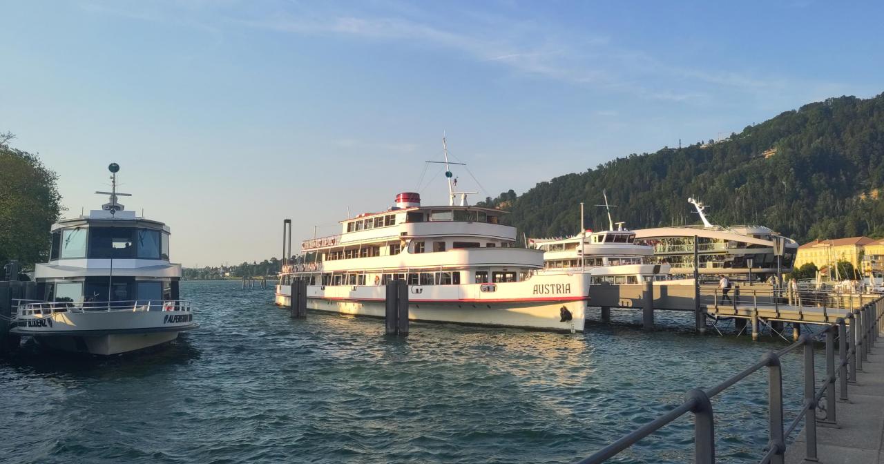
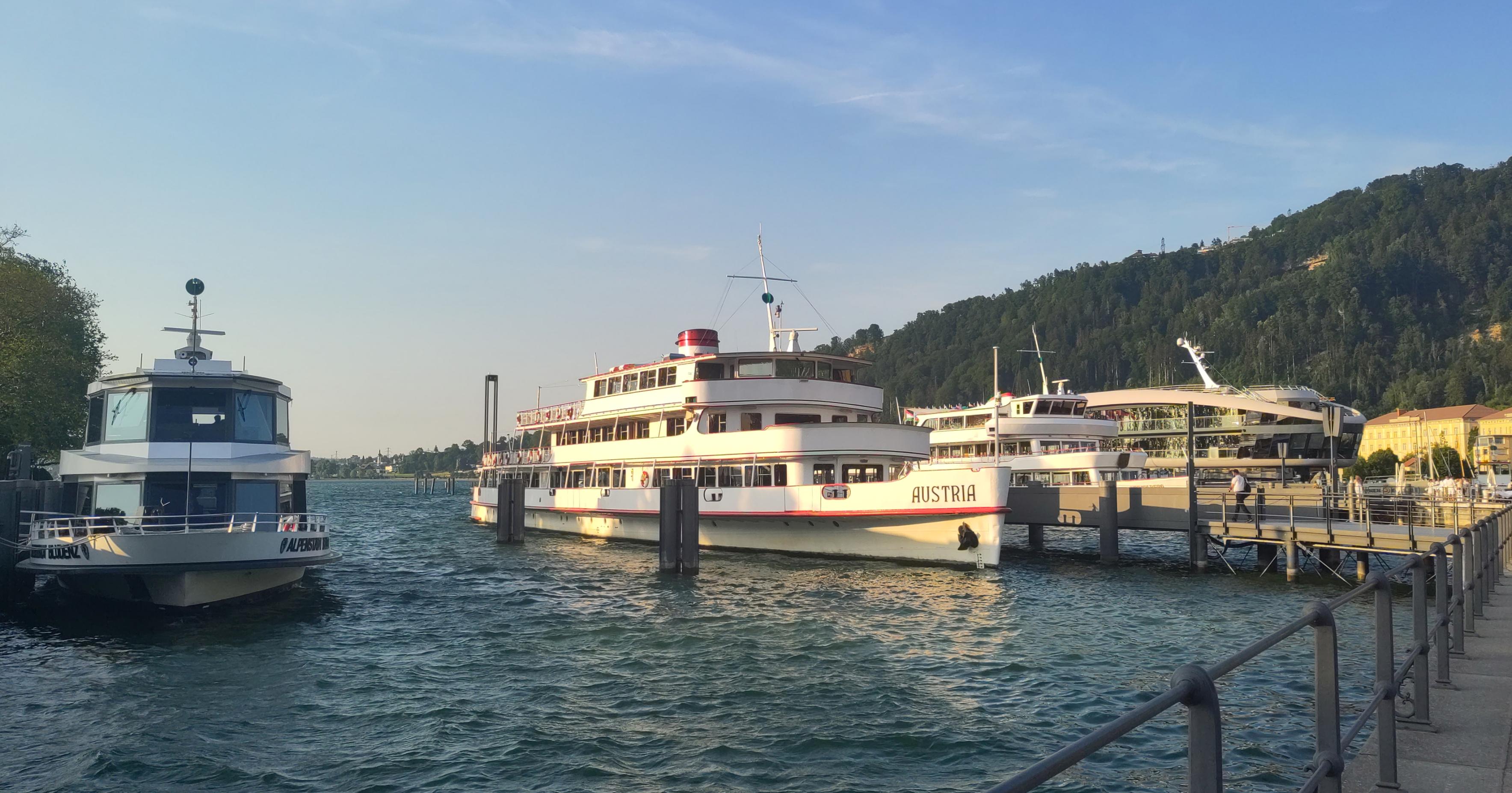
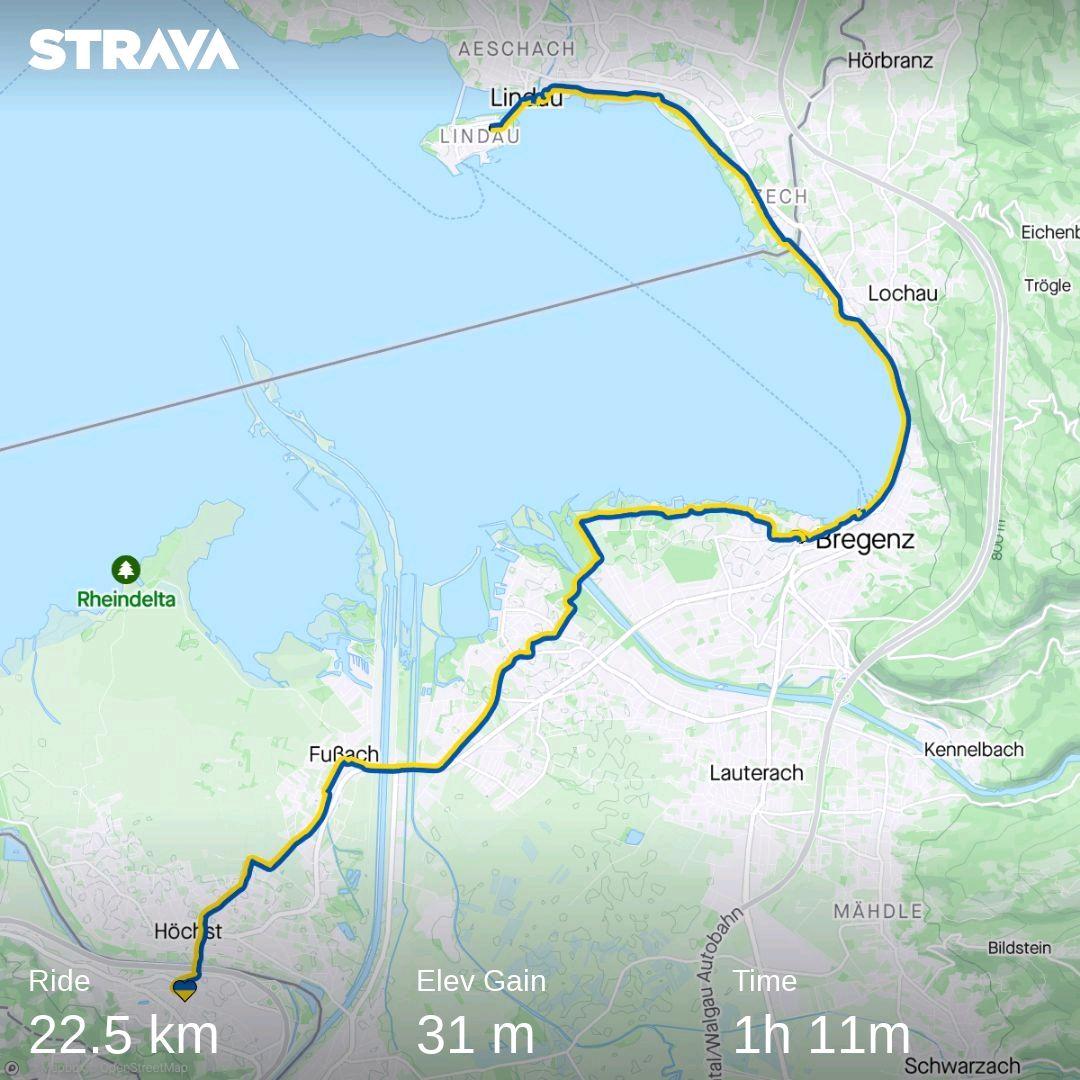
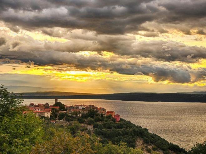
On Friday after work I took a train to St Margrethen, the nearest Swiss station to the border with Austria, and then rode the 20-odd kilometres to Lindau in Germany. This was cheaper and less hassle than booking an international ticket with the bike, and gave me a nice little warm-up ride. The harbour town of Bregenz and the old island town of Lindau basked elegantly in the evening sunshine. I had to work quite hard against a stiffish northerly breeze, which I didn't really mind, as I hoped it would keep going next day - when my route would head pretty much due south.
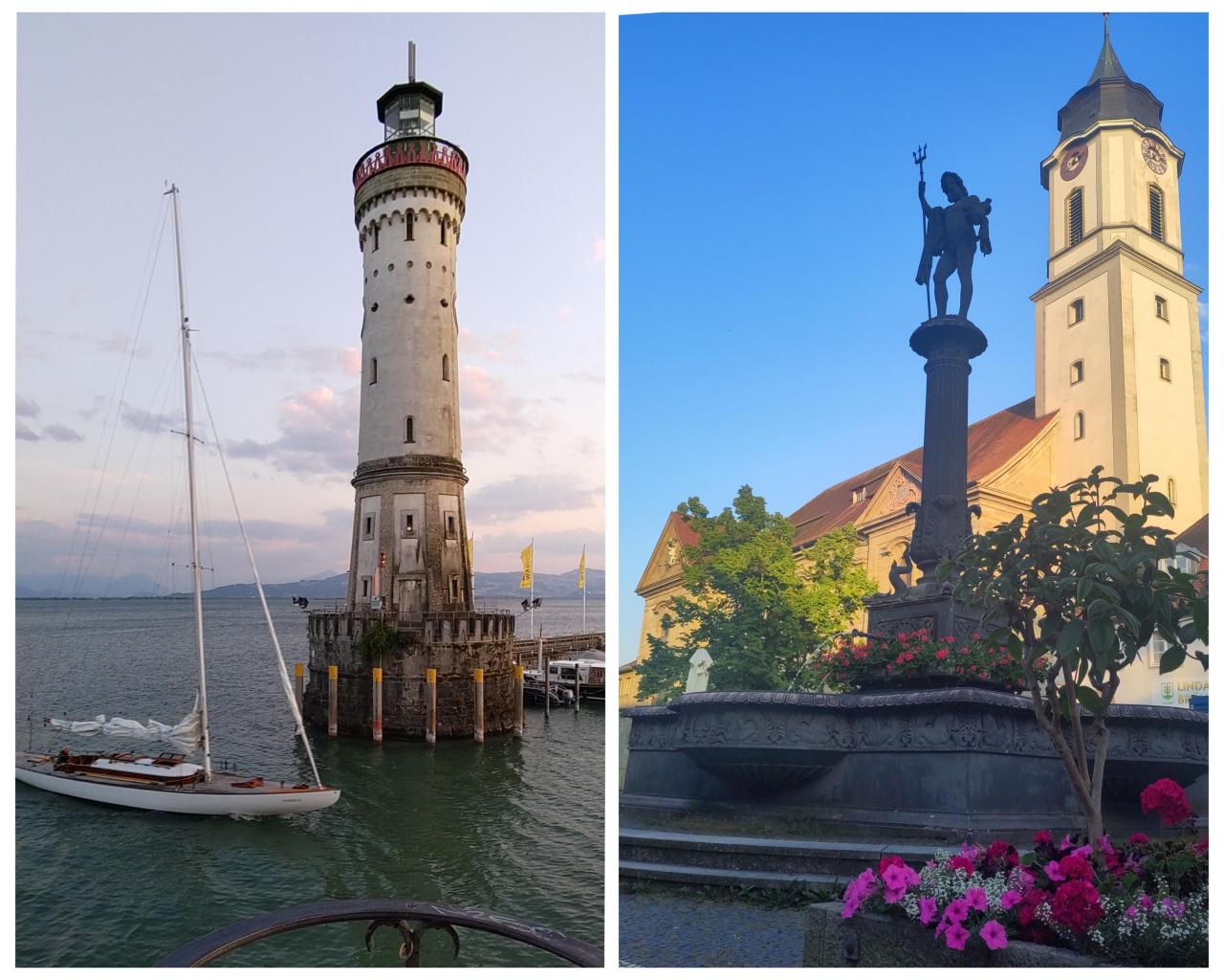
In Lindau I'd booked for one night in a self-catering holiday flatlet, which gave me the flexibility to get on the road early without having to worry about hotel check-out or breakfast times. Filled pasta and a packet of salad fulfilled my dinner needs, and I popped some yogurt in the fridge for breakfast. It was 05.20 by the time I'd washed up and returned the keys to the lock box outside, and started turning the pedals. Doing a ride like this in June meant I could take full advantage of the long day length.
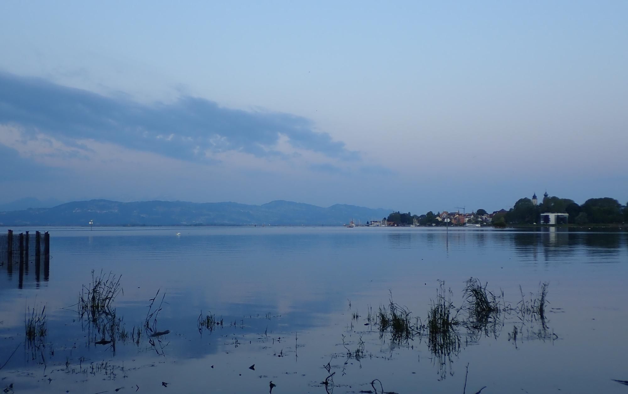
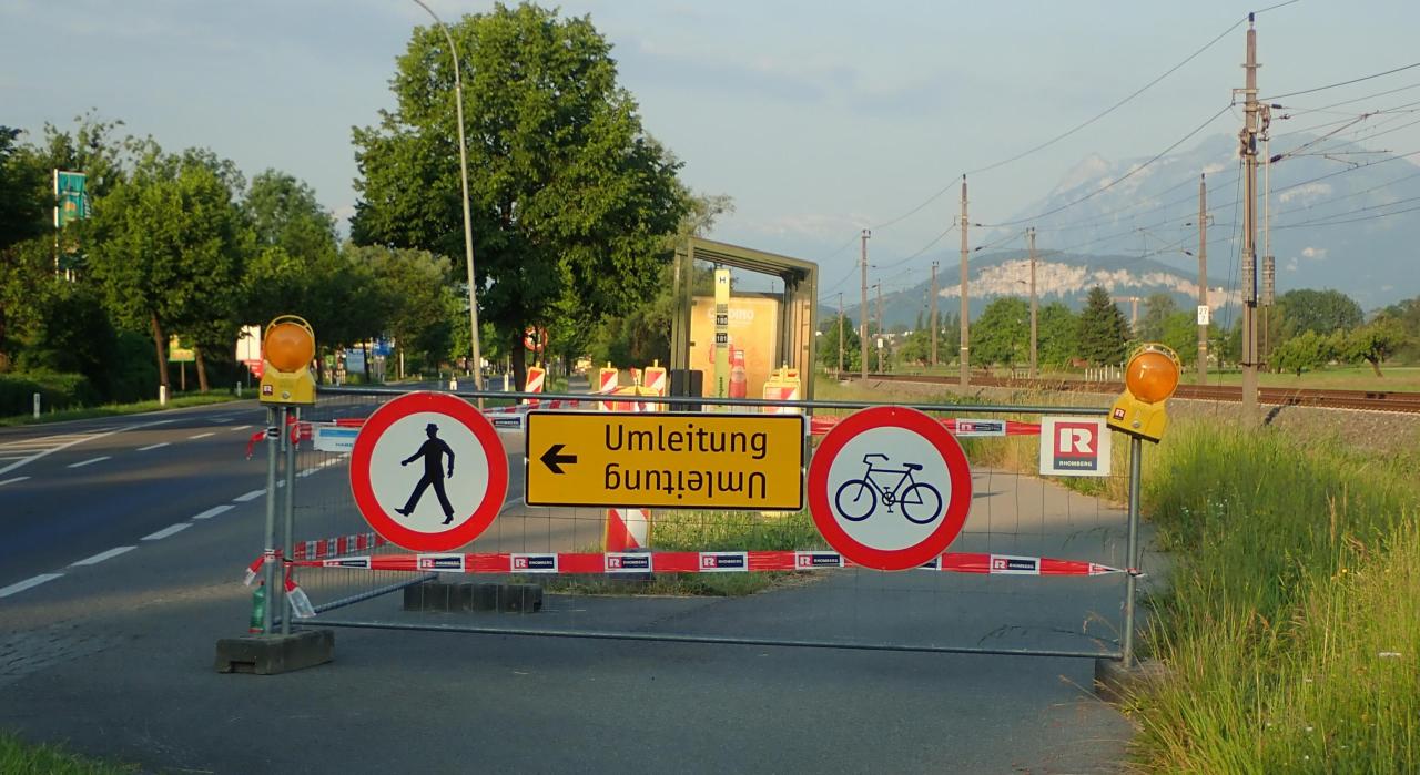
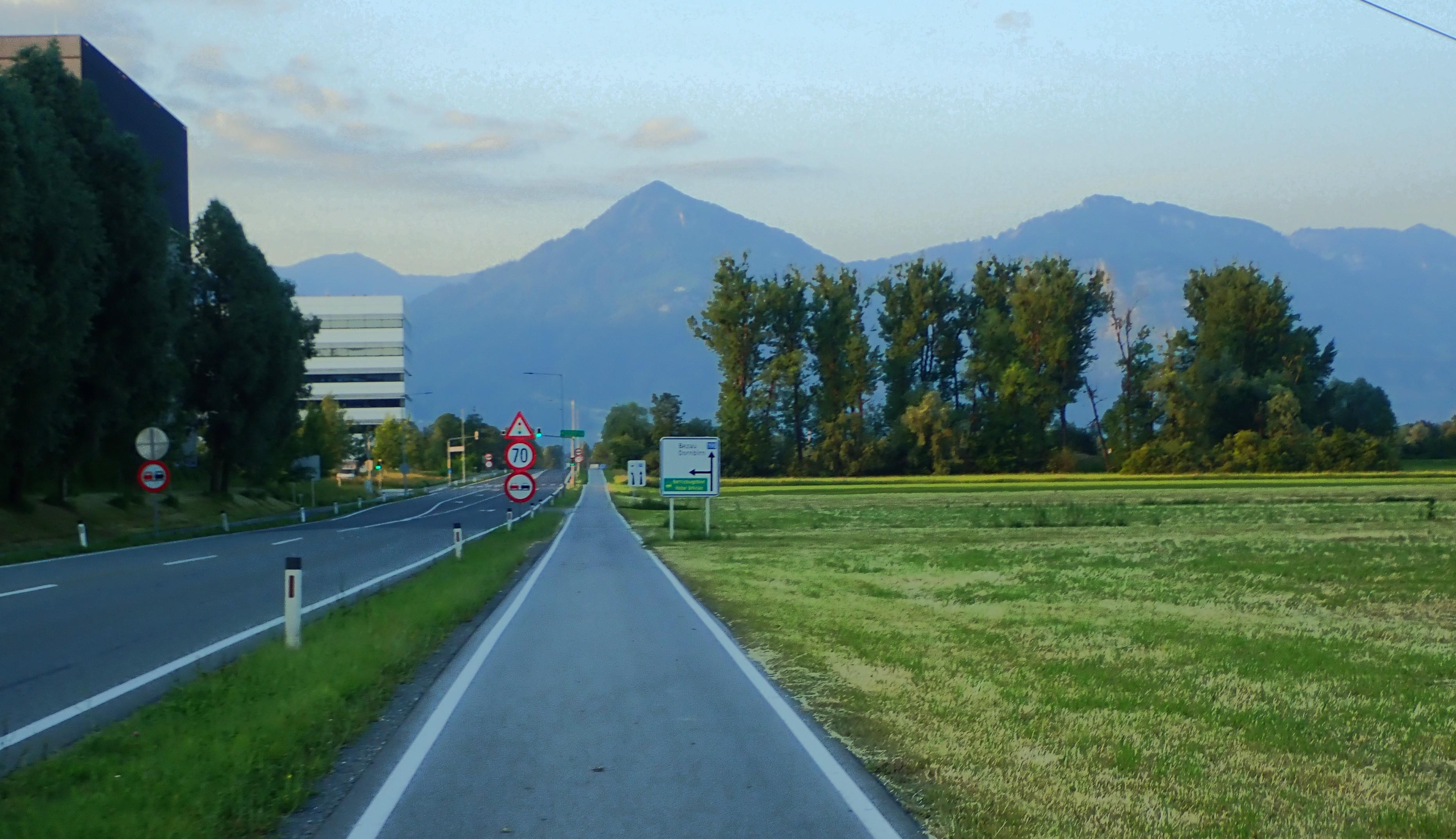
After just 20 minutes I was already crossing back into Austria again, retracing Friday evening's route as far as Bregenz, where I headed inland and encountered the first of several bike path closures which seemed to be an Austrian feature; inconvenient, maybe - but good to see them investing in their cycling infrastructure. After traversing the suburbs, a bike path beside the main road speared southwards across open fields with the Alps beckoning in the distance.
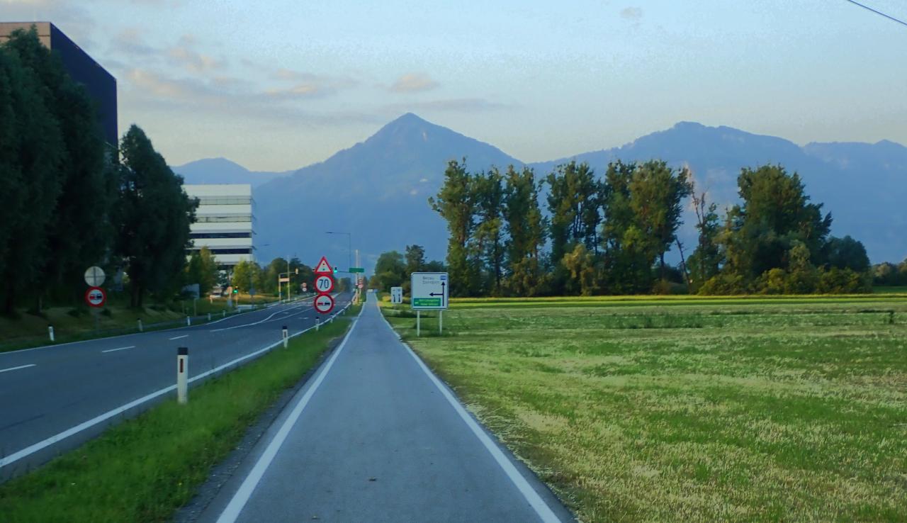
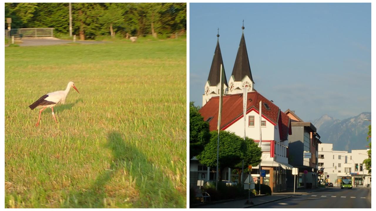
Storks strutted around; bright white-painted spires caught the morning sun. The bike path itself might have been dull, but as a bit of "kilometer fressen" to get the day off to a flying start, I was perfectly happy!
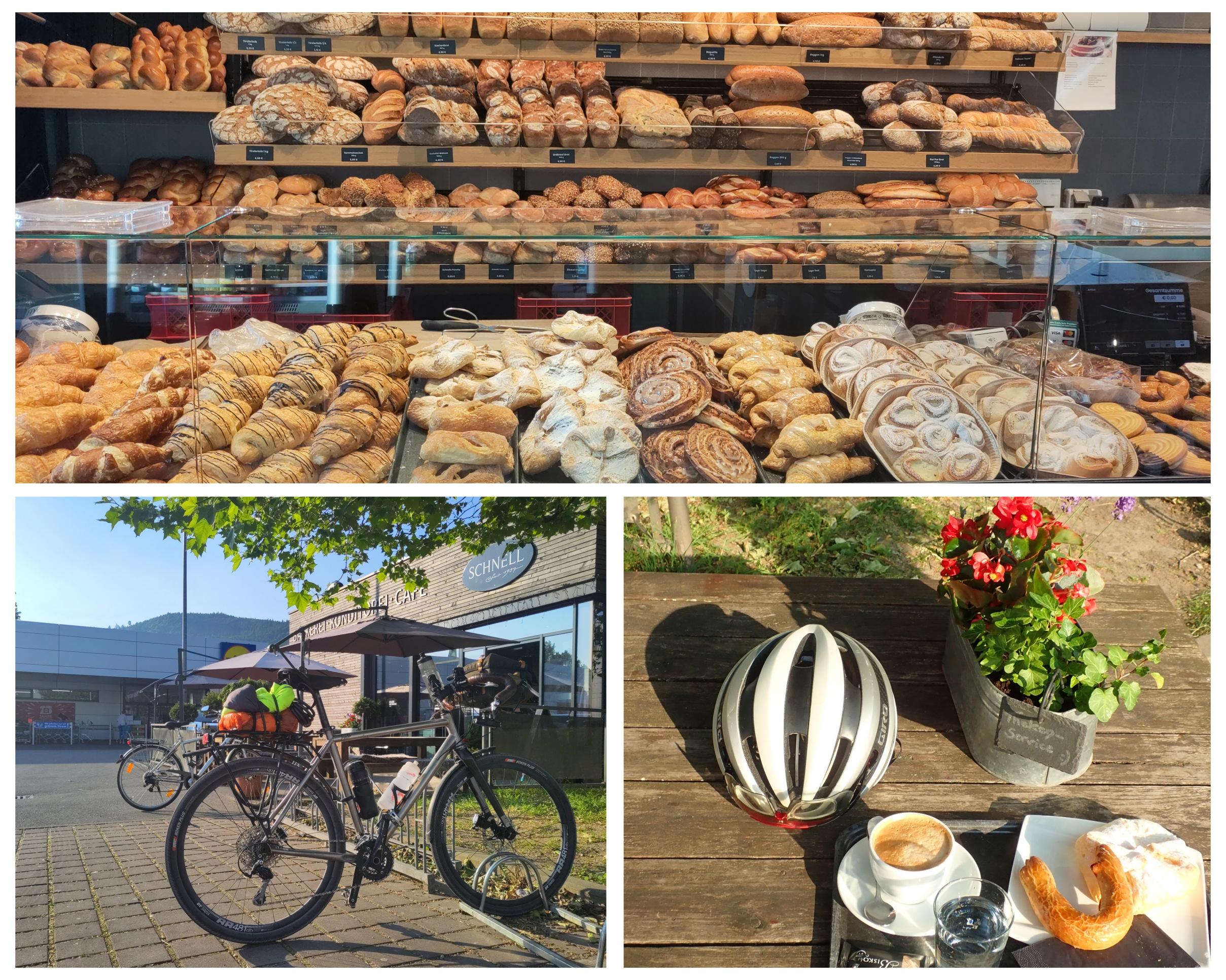
I passed several enticing bakeries - they open early here - but I had made up my mind not to stop for my second breakfast before 07.30. Look where I found myself at precisely 07.32!

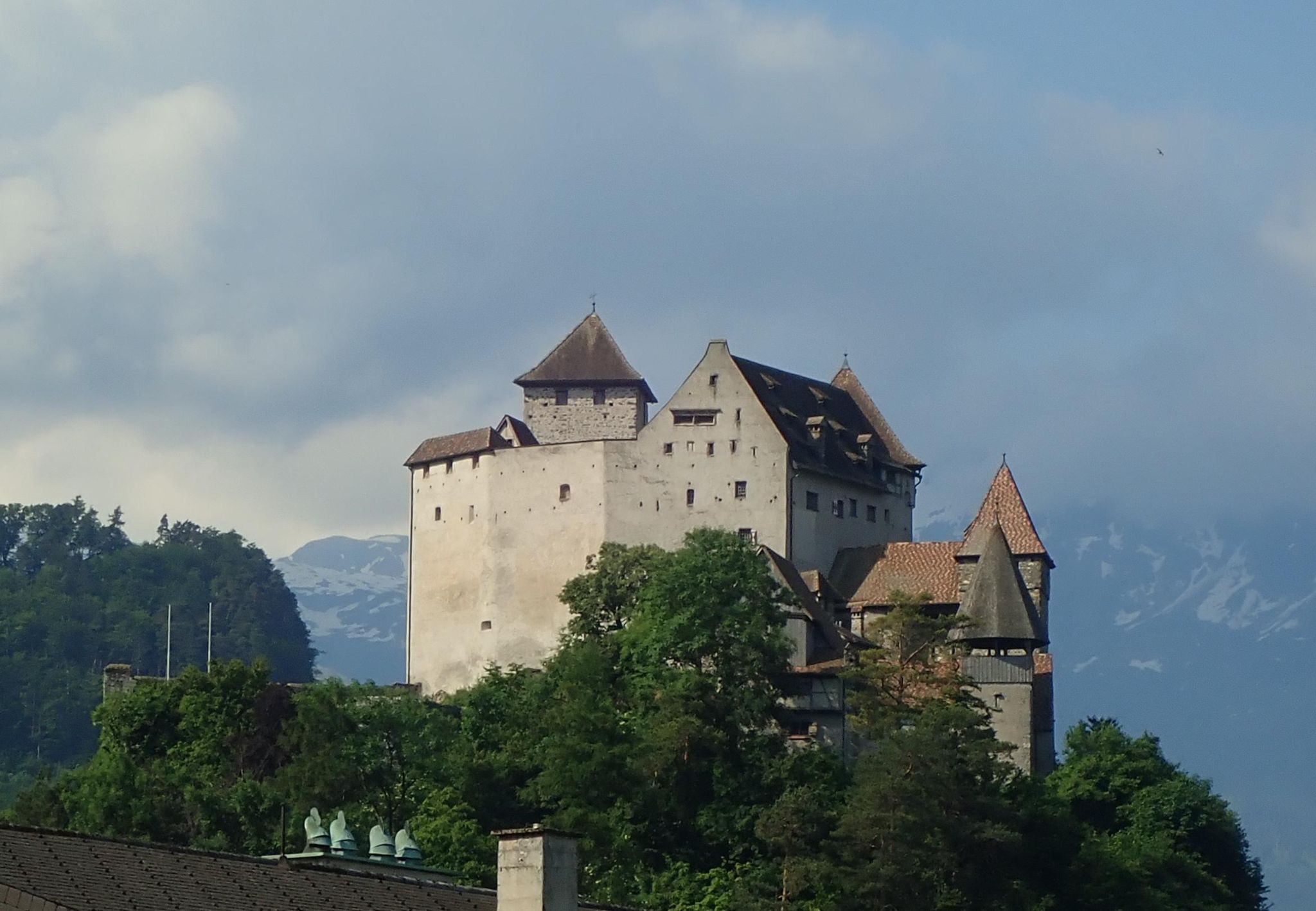
Half an hour or so after setting off again from the bakery, and almost exactly 50km into the ride, I was collecting my third country of the day when I crossed into the Principality of Liechtenstein. My route had taken me onto field tracks at this point - suddenly busy with Saturday morning runners and dog walkers - and my first inkling that I had actually crossed the border was that there were Swiss-style bike route signs; it seems that Liechtenstein is integrated into the Swiss cycling network. (I was disappointed not to find a proper border sign as I had been hoping to collect a photo collage of the signs of all five countries!) Liechtenstein has many castles, and the church spires are faced in natural stone as opposed to the dazzling white paint customary in Austria.
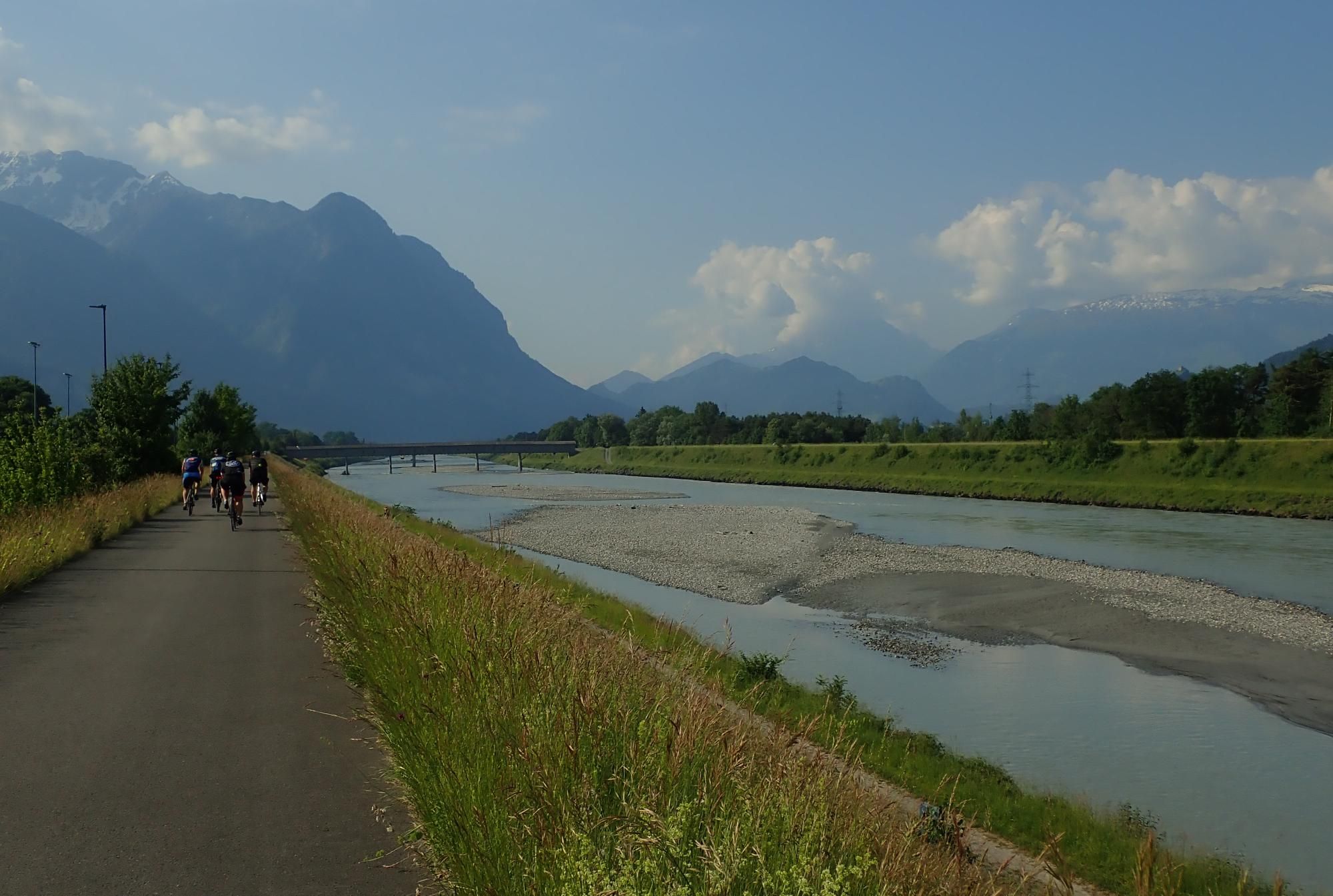
In another 40 minutes or so I had traversed Liechtenstein and reached the river Rhine, which was to be a feature of most of the rest of the ride, and which at this point forms the border between Liechtenstein and Switzerland. For the time being I stayed on the Liechtenstein side, heading south on the embankment path, where I found myself in the middle of some kind of cycling event; I think I confused the marshals by arriving at a control point from an unexpected direction!
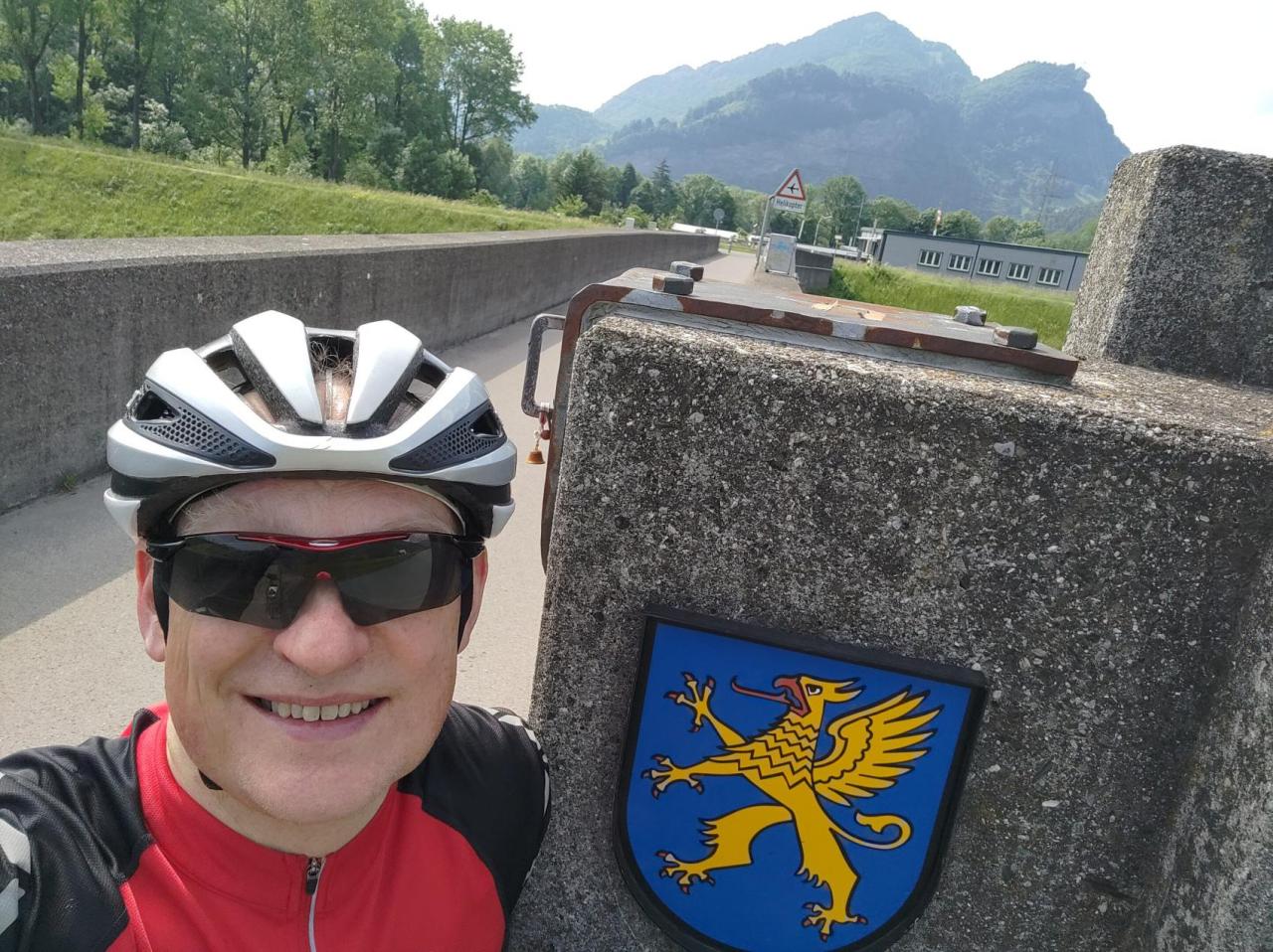
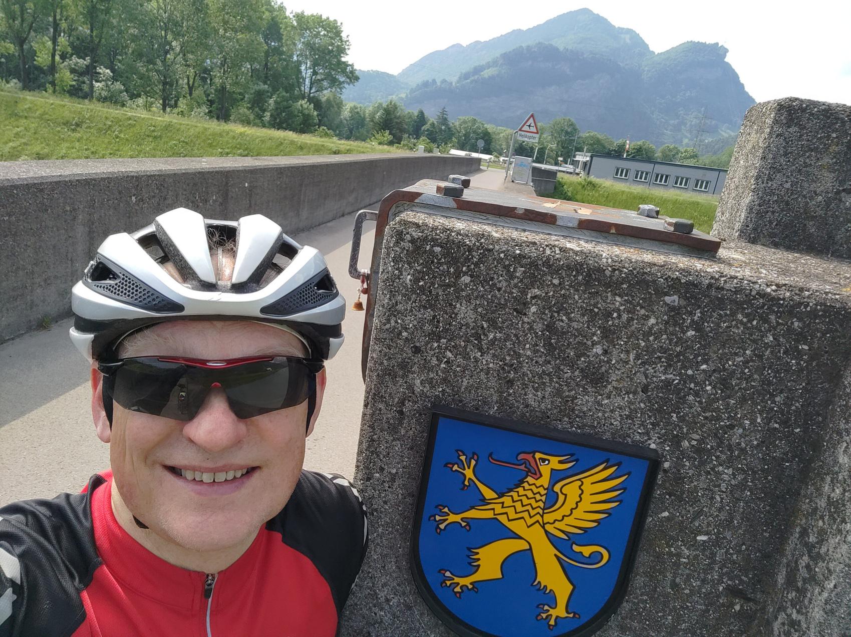
Eventually the Liechtenstein side runs out of road at a point where the river flows right below the cliff, and there's only room for a rough hiking trail, which would have slowed me down too much for such a long ride. Here I crossed into Switzerland - on a modern concrete footbridge - collecting my fourth country at 75km and 4¾ hours into the ride. Disappointingly, again, there was no national signage for my photographic record - only the emblems of Balzers commune (Liechtenstein) and St Gallen canton (Switzerland)
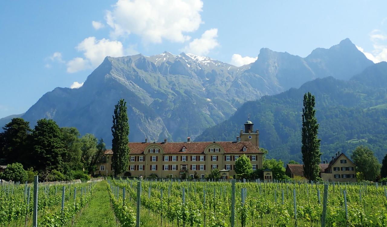
After selfies on the bridge, I continued my southward progress along the Swiss bank of the Rhine, and hooray! the breeze which had sprung up (after the early morning calm) was still from the north, like yesterday evening, blowing me nicely along - which was a stroke of luck; had the wind had been against me, it would have made an already tough ride much tougher still. I have a limited appetite for straight flat riverside paths, though, so at the first bridge upstream of those rapids, I recrossed the Rhine and took a route away from the river through the wine-growing area of the so-called "Bündner Herrschaften" villages Fläsch, Maienfeld, Jenins and Malans. (Liechtenstein was left behind by now; Switzerland spans both sides of the Rhine at this point.)
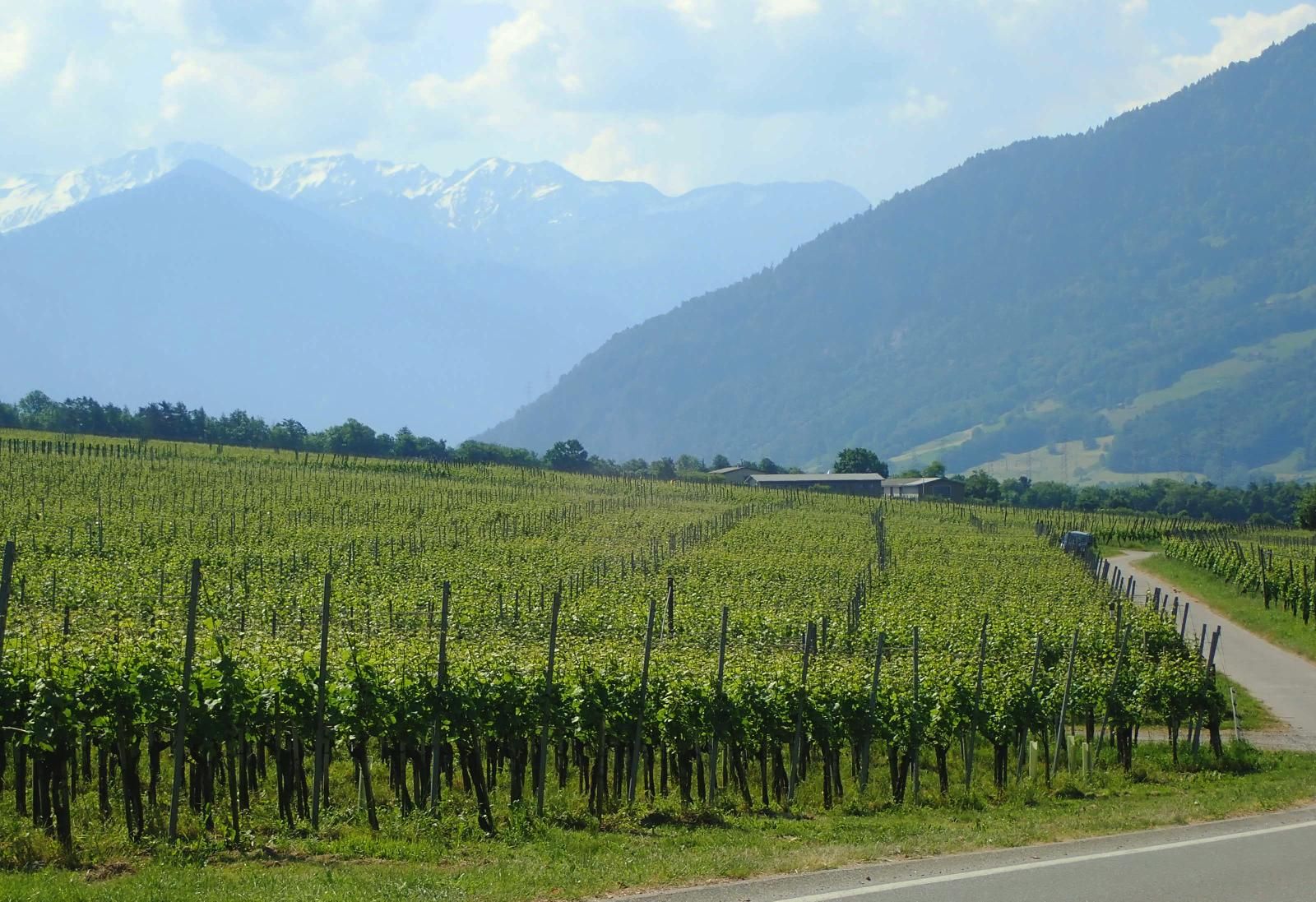
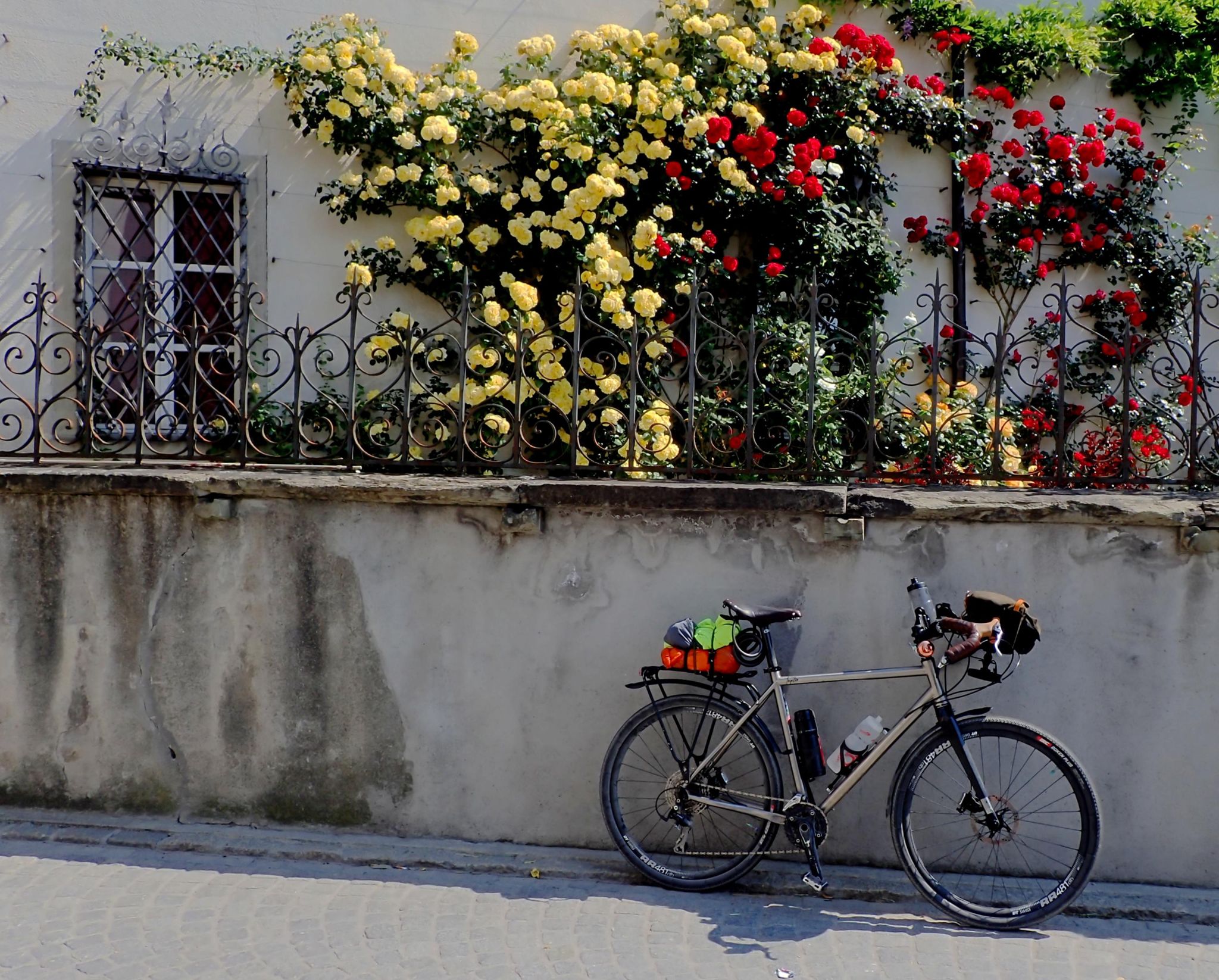
This was one of my favourite areas to visit when I lived in Zurich, both for the scenery and for its wine festivals and tastings - a spectacular sparkling wine from Fläsch stands out in the memory. Today, I wasn't going allow the wine to derail me from my mission, but I definitely could enjoy the views across vineyards to the mountains beyond, and the quaint village streets with rose-adorned traditional buildings. Also, there were a few short sharp hills between and through the villages which gave my muscles a good bit of pre-conditioning for the big climb still to come later.
After the exhilaration of swooping through the vineyards, it was back down to earth with a bump (specifically, to river level) for a dreary and hot slog through the industrialised towns of Landquart & Chur. I was getting hungry again by now and I was counting down the kilometres to Thusis, where the ascent to the Splügen Pass begins in earnest and where I had promised myself a proper meal break before tackling it. My route mapping said it was only 30km further on from Chur, but from my mental perception of the geography it felt like it should be a lot more, which for a time made me feel despondent about my rate of progress. (The mapping was correct, of course!)
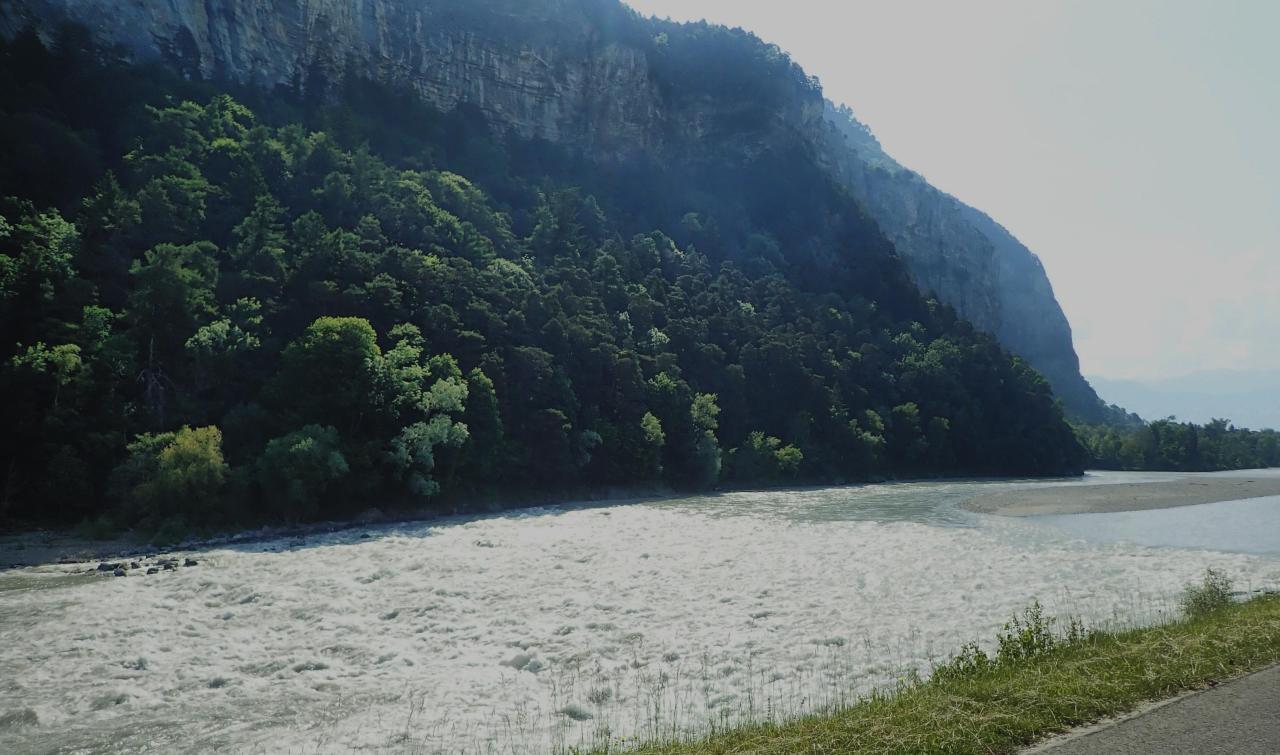
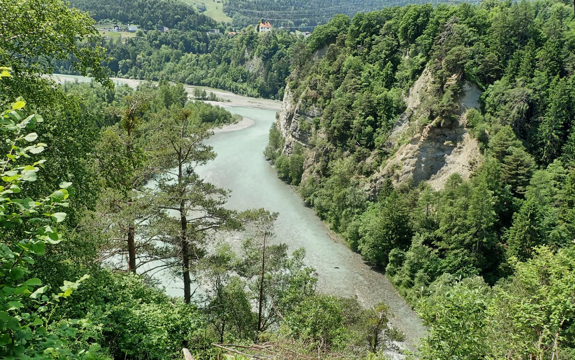
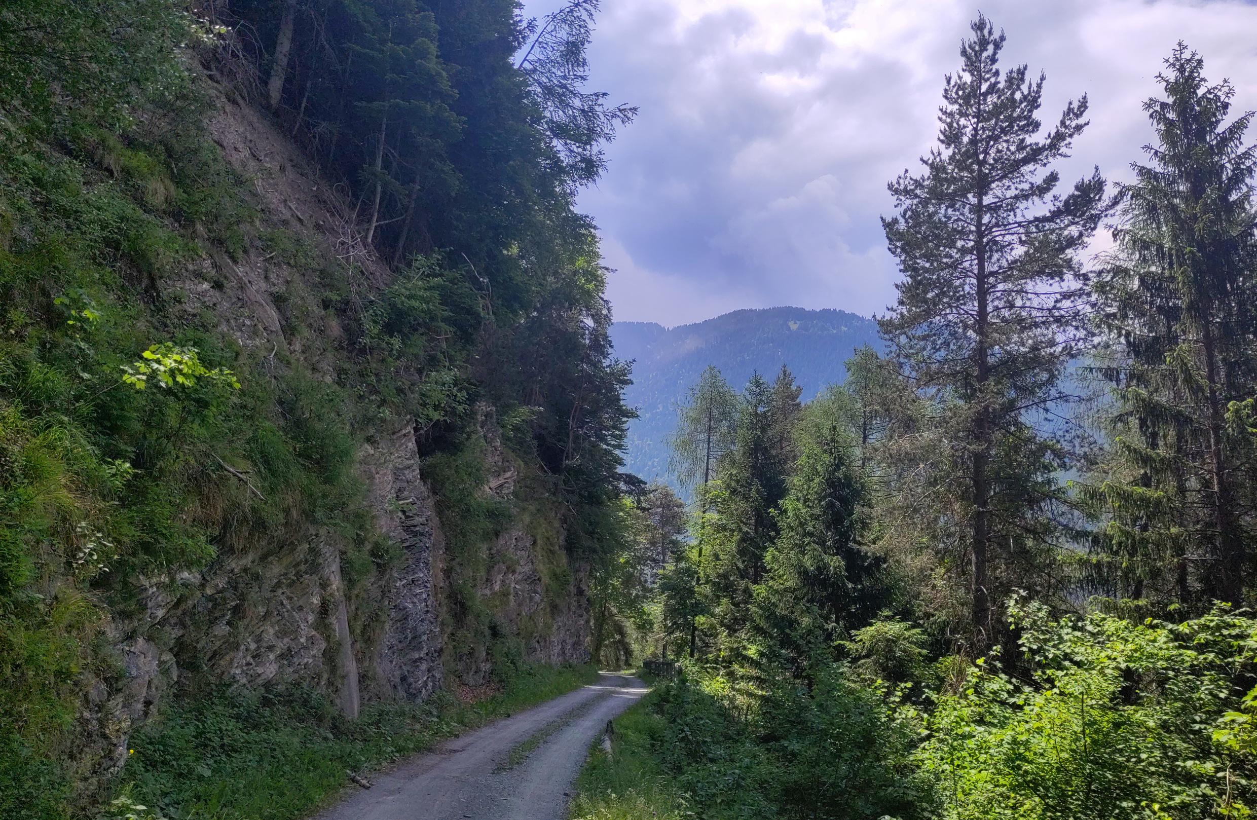
Between Chur and Thusis the route made a second excursion into the hills overlooking the river. This also formed the official roughstuff section of the ride - it wouldn't be a "Tom route" without it! - where the Swiss Cycling Route #6 takes a gravel trail high above the Rhine gorge with breathtaking views down and across it.

Slowed down by the terrain and the photography stops, I reached Thusis around 14.00 - still within my planned time window to complete the ride before nightfall, and still feeling in surprisingly good shape after 138km (apart from being hungry!). From a previous visit to Thusis I remembered a café serving wonderful Bündner Nusstorte, a regional sweet speciality, but I was after a full scale meal this time; so I stopped at the first likely-looking restaurant and ordered cordon bleu and chips. I also ordered a seat by a power socket, as my phone had started gobbling its battery and wouldn't last through the rest of the ride. To be on the safe side, I saved my Strava activity so far, rebooted the phone, and logged the rest of the ride as a second activity, gluing the two back together afterwards using a nifty free utility from gotoes.org
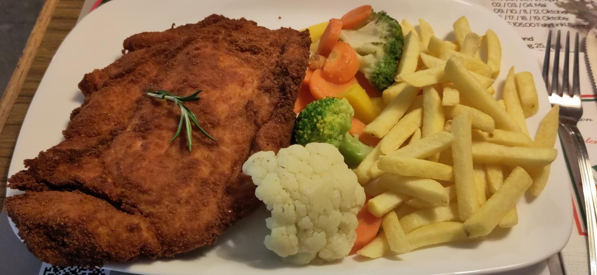
Sadly, this establishment didn't offer Bündner Nusstorte, so I contented myself with just a double espresso to finish, before setting off on the final phase of my ride: "only" another 40km to go in terms of distance, but some 1400m of altitude to climb, to reach the summit of the Splügen Pass.
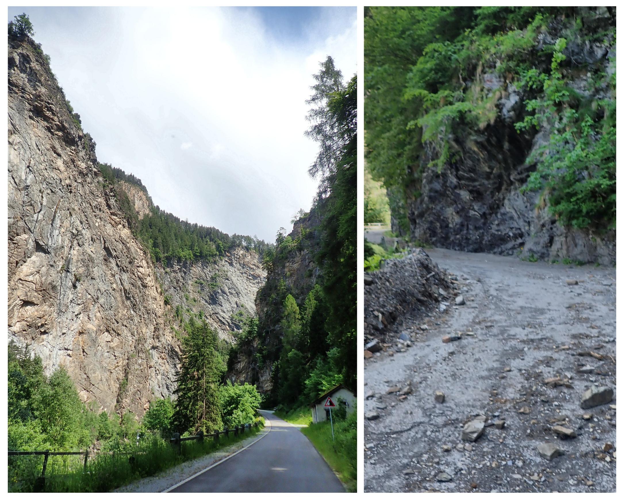
Immediately upon leaving Thusis, the route entered the notorious Via Mala gorge (Latin "bad road"), where the Rhine flows through an extremely deep and narrow gorge, forming a natural obstacle to traffic using the Splügen and San Bernardino passes. The Roman road-builders cut galleries into the side walls of the gorge to make transit easier, and various engineers have attempted improvements ever since. The latest iteration is a motorway tunnel, deep inside the rock; the bike route starts out along an abandoned earlier motor road, complete with fallen rocks and other debris, before joining the current non-motorway road further up.

At this point, I was getting a bit nervous about the weather, as there was rain - with localised thunderstorms - forecast for the later afternoon and evening, and even by the late morning when I was traversing the vineyards I could see tall clouds building up above the mountains ahead. There were the odd few raindrops in the air as I was locking up my bike outside the restaurant, and again as I traversed the Via Mala. As the valley opened out again and I continued to climb through the villages of Zillis and Andeer, the road was very wet, showing that there were indeed some heavy rain showers around - they had just missed me, so far.

Andeer provided an opportunity to refill my water bottles to see me through to the top of the pass. My rule no.1 of cycle touring is whatever else you run out of, never run out of water! The Swiss make this very easy by providing drinking water fountains in (almost) every village; the catch is in the "almost", as the coverage can be patchy in places, especially once you get into the mountains. So my policy was always to refill well before the first of my two bottles was empty.
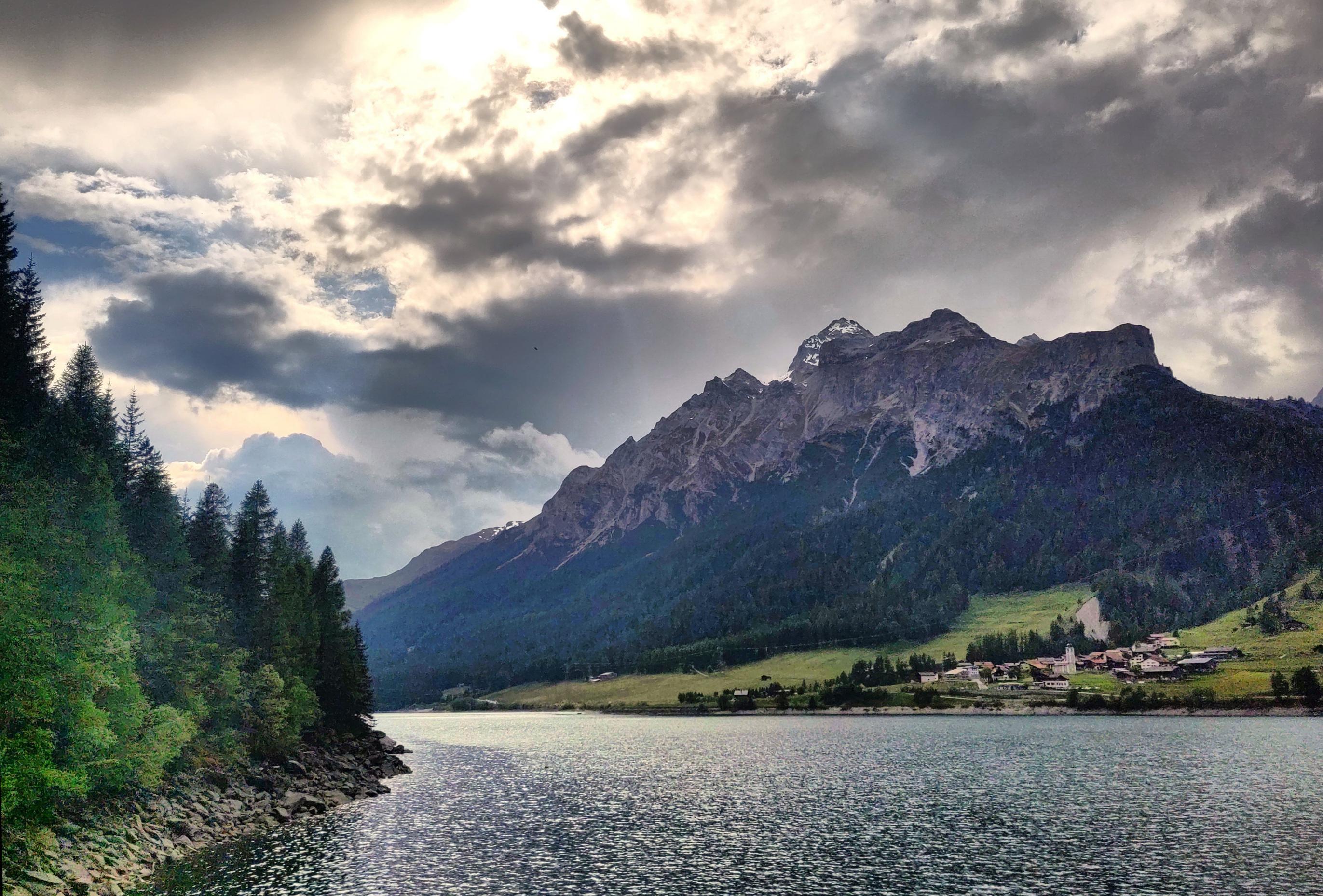
After Andeer, the road climbed again through several hairpins, crossing another dramatic gorge where a side river flowed into a small lake.

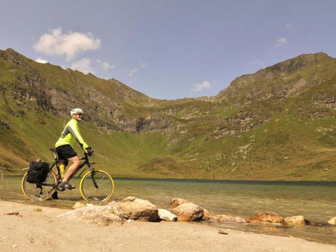
I'd been going well so far, but the top of this mini-climb I suddenly began to feel slightly faint and shaky, so it was time for another snack stop to stave off the dreaded "bonk". Here the route flattened off to skirt the shore of another small lake. While munching on a muesli bar, I checked my ride stats and found that I had exactly reached 100 miles (161km) as well as being exactly halfway through that 1400m climb from Thusis; "only" another 700m to go!

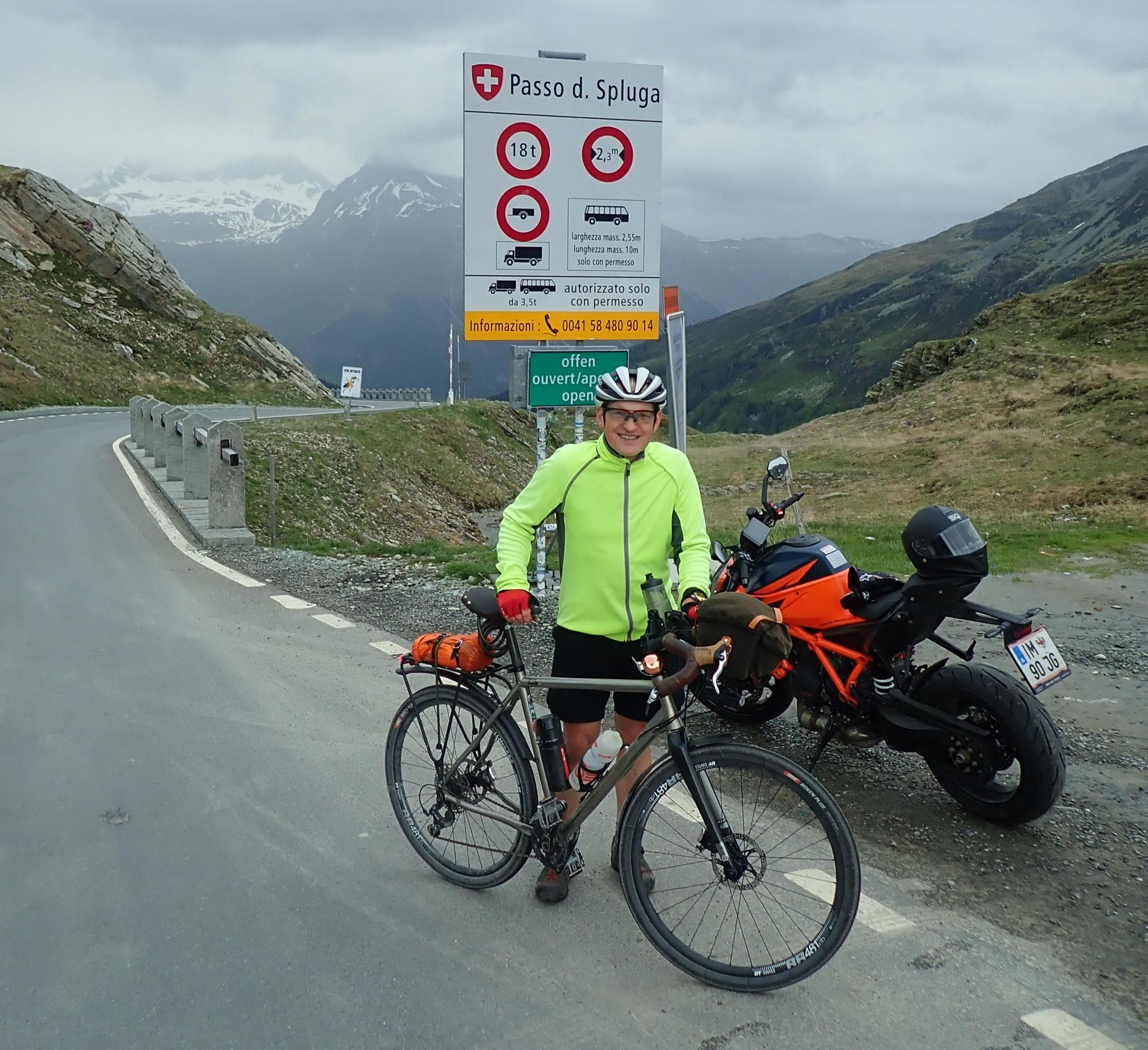
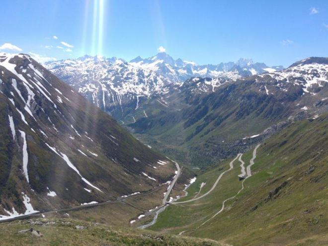
At the far end of the lake I at last reached the village of Splügen, where the routes to the Splügen and San Bernardino passes diverge, taking me into new-to-me territory; I've ridden over the San Bernardino before, in the opposite direction, but never over the Splügen Pass. I only stopped long enough in Splügen for a quick photo and extra top-up of my water bottles before pressing on. I was anxious to reach my overnight stop in Montespluga in good time for dinner, and also to outrun the weather, which I could see closing in rapidly over the pass ahead.
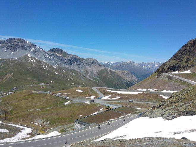
I'd honestly been expecting to be on my last legs by this point of the ride, so it was quite a surprise to find that I was still going well: taking things steady, using my lowest gears, ticking down the altitude on my watch altimeter 50 metres at a time. The pass doesn't have any really extreme gradients - all nicely engineered with smooth hairpin bends - and at this time of the evening there was almost no traffic, so I enjoyed a very peaceful ride.
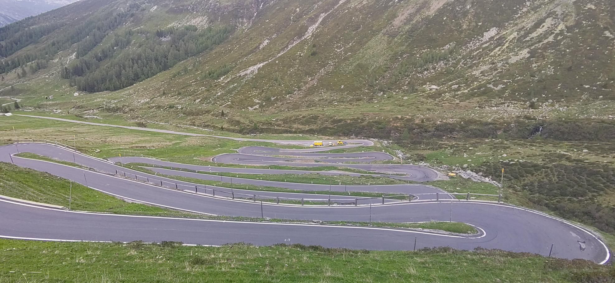
When I stopped for a few moments to photograph the impressive flight of hairpins (photo above), suddenly a big clap of thunder sounded from across the valley, giving me a hurry up to get back on my bike! Luckily that single thunderclap stayed single. Not long afterwards, the Italian border - 5th country, mission objective accomplished! - and the pass summit took me quite by surprise, as my altimeter had gone off calibration and I thought I still had 50m or so to go. A friendly motorcyclist took my photo for me at the summit sign.
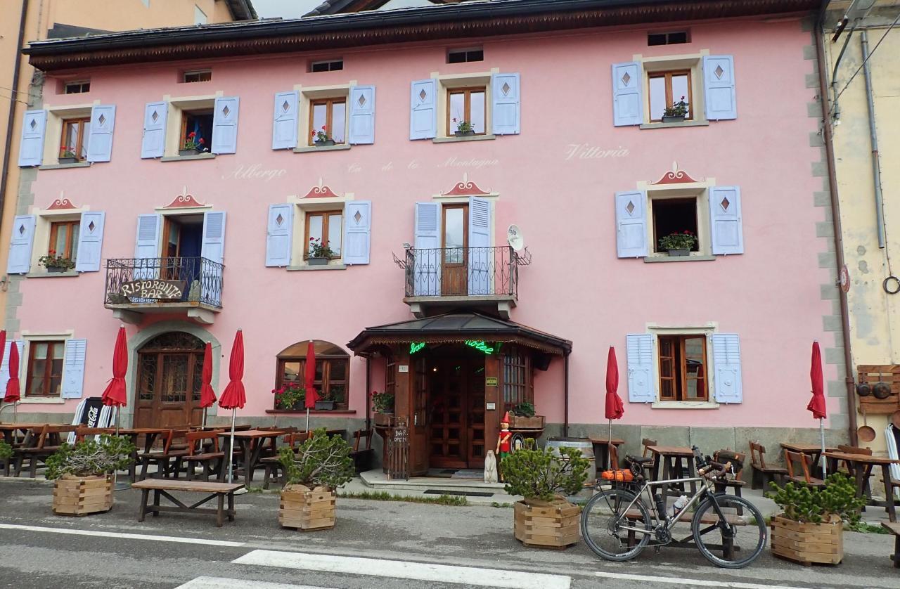
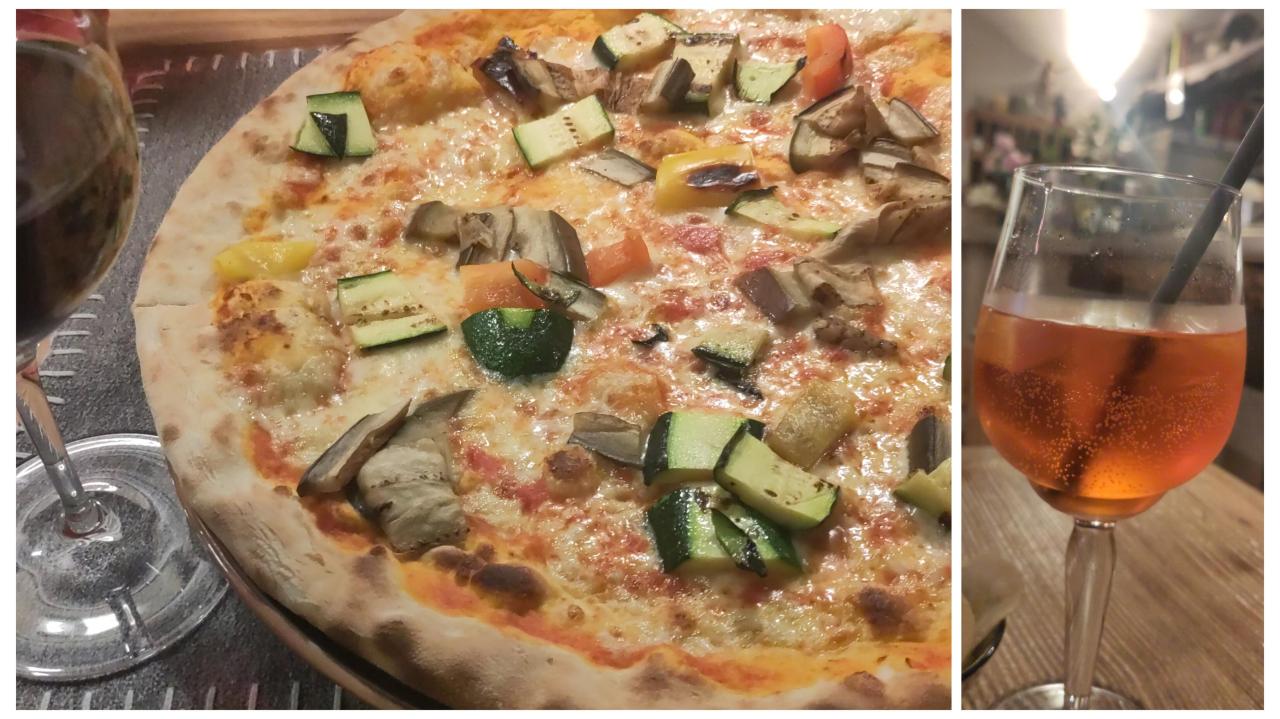
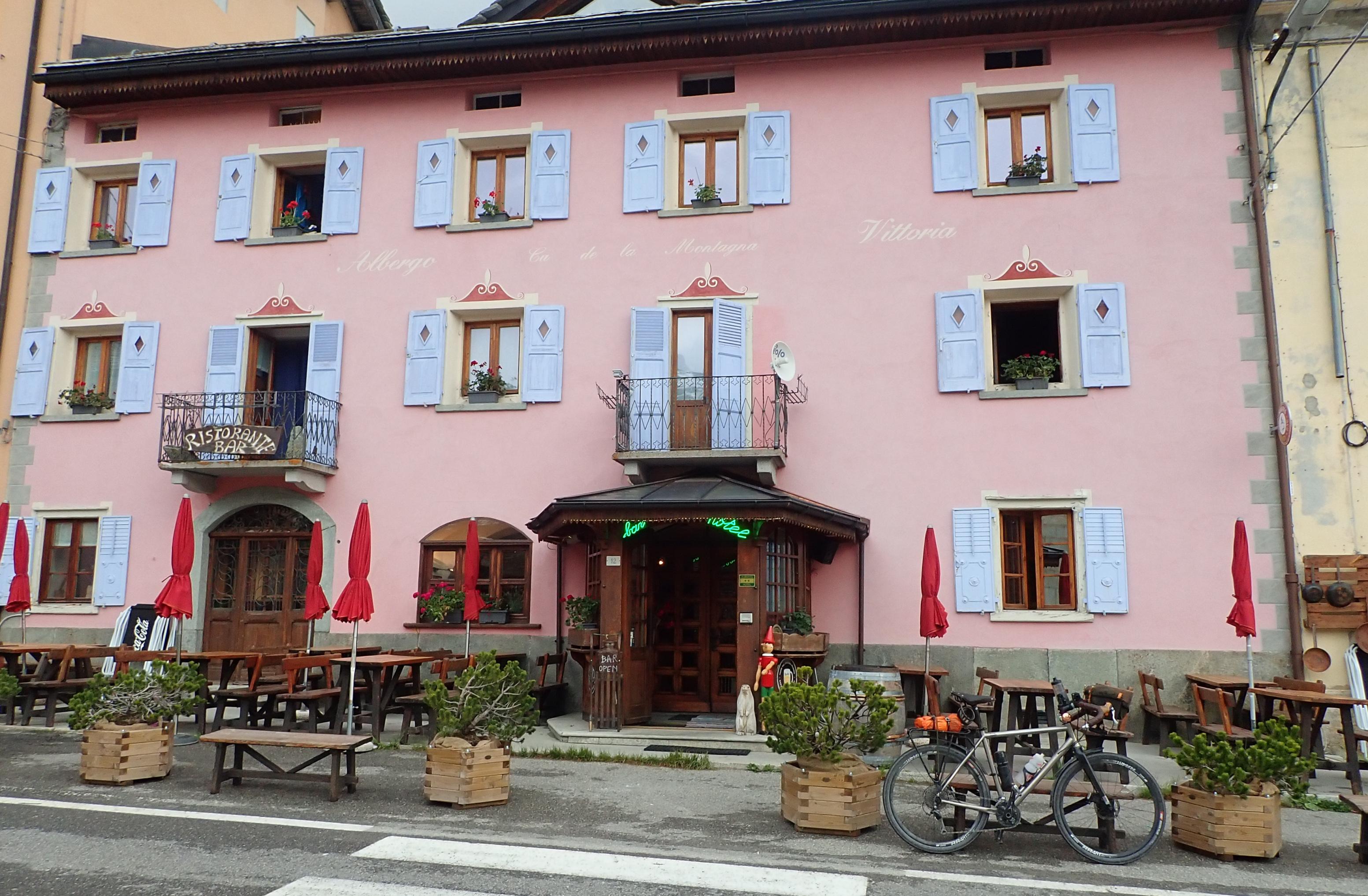
Then it was just a couple of kilometres down on the Italian side of the pass to the little Hotel Vittoria in Montespluga, where I had my bike garaged, and myself settled in with a celebratory Aperol Spritz by 20.00. By the time I left the hotel again to walk to the nearby pizzeria, it was pouring with rain
Postscript: I got chatting to another cyclist at the hotel who happened to be from Feldkirch - and recognised the bakery I had been to this morning; she'd taken the train as far as Thusis and had been a couple of hours ahead of me heading up the Splügen Pass. "Wasn't it awful with that rain?" she said, "It rained ALL the way up the pass!" It seems I'd been incredibly lucky with my timing!


Please login to save your comment